


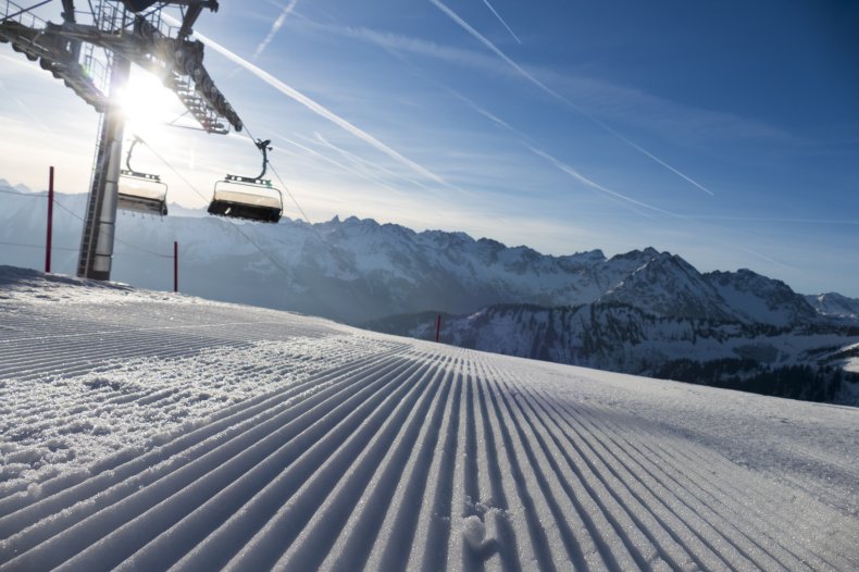
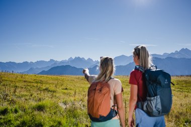
Fantastic views from the cross-border hiking area Fellhorn/Kanzelwand.
Experience stunning views while hiking on the Fellhorn and Kanzelwand
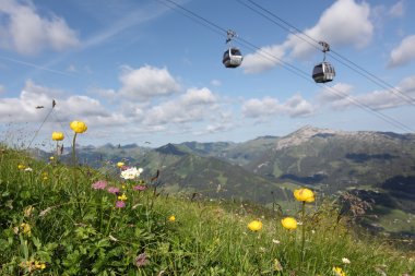
In the two-country region in the Allgäu between Germany and Austria, you'll cross very special borders. You can safely forget about a passport at the Fellhorn and Kanzelwand, as the peaks connect the Austrian Kleinwalsertal and the German Allgäu without any border controls. While hiking on the Fellhorn and Kanzelwand, you'll stroll through lush meadows full of mountain flowers, past babbling streams, and can take a break at clear mountain lakes. In summer, the Riezler Alpsee, for example, is a great place to do this. Leave the ascent to the Oberstdorf Kleinwalsertal Bergbahnen, which will comfortably take you to the mountain stations. We've compiled the best hikes between Allgäu and Kleinwalsertal on this page.
Experience breathtaking views while hiking on Fellhorn and Kanzelwand.
Hiking on the Fellhorn and Kanzelwand mountains means crossing a very special border in the Allgäu region, which straddles the border between Germany and Austria. You can forget your passport on the Fellhorn and Kanzelwand, as these peaks connect the Austrian Kleinwalsertal valley and the German Allgäu without any border controls. On hikes on the Fellhorn and Kanzelwand, you'll stroll through lush meadows full of wildflowers, past babbling brooks, and can take a break at crystal-clear mountain lakes. In summer, the Riezler Alpsee, for example, is a particularly inviting spot. Leave the strenuous climb to the Oberstdorf Kleinwalsertal mountain lifts, which will comfortably transport you to the mountain stations via the Fellhornbahn and Kanzelwandbahn lifts. We've compiled the best hikes on the Kanzelwand and Fellhorn for you on this page.
`` ... We also have a tip for when it's snowy and cold: Families can enjoy the snow-covered region with Winter hiking at Fellhorn and Kanzelwand!
...``
``
```
```
```
```
``
All the important information at a glance:
- Elevation: Fellhorn 2,037 m a.s.l., Kanzelwand 2,058 m a.s.l.
- Location: Oberstdorf, Allgäu Alps; summit directly on the border between Kleinwalsertal and Stillachtal
- Tours: Family hikes, panoramic and themed trails, alpine pasture hikes, moderately difficult mountain tours (Fellhorn ridge, Söllerkopf, Kanzelwandscharte), high-alpine trails
- Hiking time: 30 minutes to 6 hours, 14 tours; Summit ascents approx. 30 min., Two-Country Circular Hiking Trail approx. 2 hours
- Highlights: Flower Mountain with over 120 flowers and plants, large alpine rose fields, free botanical tours, Schlappoldsee lake, Alpe Schlappold alpine pasture, Fellhorn ridge, Two-Country Circular Hiking Trail, Riezler Alpsee lake, Rote Wand (Red Wall), Burmiwasser (Burmi Water), Bergschau 2037 (Mountain View 2037), Two-Country Via Ferrata (C to D difficulty)
- Character: Scenic hiking mountain, alpine pasture farming, nature experience, border region of Bavaria/Vorarlberg; Kanzelwand mountain with its main dolomite peak and steep north face
- For whom: Families, leisurely hikers, mountain hikers, summit seekers; Trail 12 is suitable for strollers; strollers travel free on the cable car.
- Mountain Railway: Fellhorn Cable Car: Valley (Stillach Valley), Schlappoldsee middle station (1,780 m), summit station (1,967 m), plus summit lift. Kanzelwand Cable Car from Riezlern, summit in 20 minutes.
- Refreshments: Numerous alpine pastures, mountain restaurants, and huts around Fellhorn and the Schlappold area.
Interactive hiking map Fellhorn - Kanzelwand
The interactive panoramic map of the Fellhorn Kanzelwand cross-border region provides an overview of the hiking and leisure area in the border region between Germany and Austria. It shows not only all hiking trails but also important information such as restaurants, parking lots, bus stops, and more. With this hiking map, you can optimally plan your tours, discover our "Adler7 Spots" (/aktiv-sport/adler7/), and easily find the best mountain restaurants or rest areas. It's the ideal orientation tool for experiencing and enjoying the diverse landscape of this two-country region.
Route 1: The Two-Country Circular Trail
Hike Details
Hiking time: approx. 2 hours
Difficulty: easy
This circular hiking trail offers the perfect opportunity to explore the border region of two countries. Several variations are possible. For example, start at the Kanzelwand mountain station and hike via the upper Bierenwangalpe to the Fellhorn cable car's middle station. Just a few meters along the trail, you'll catch sight of the Riezler Alpsee, sparkling deep blue amidst green alpine meadows. Take the cable car to the summit station, from where you can climb the Fellhorn peak. The family-friendly and well-maintained trail then leads along a nature trail to the Rote Wand viewing platform, offering unparalleled views over the Kleinwalsertal valley, before returning to the Kanzelwand mountain station.

Kanzelwand-Fellhorn summit hike
Hike Details:
Hiking time: approx. 30 minutes each way
Difficulty: easy
Experience the fullest: From both the 2,036-meter-high Kanzelwand and the 2,037-meter-high Fellhorn summit, hikers enjoy panoramic views across the Allgäu Alps and far into the Kleinwalsertal valley. Well-maintained hiking trails lead from the respective mountain stations of the Fellhorn or Kanzelwand cable cars to the highest points, allowing leisurely hikers, beginners, and families to enjoy this unique panorama. The contrasting geological features of these two sister peaks—the ruggedness of the Kanzelwand and the flower-filled gentleness of the Fellhorn—make both ascents a memorable experience.

Burmi water
Details about the Hike for Children
Walking time: approx. 30 minutes
Difficulty: easy
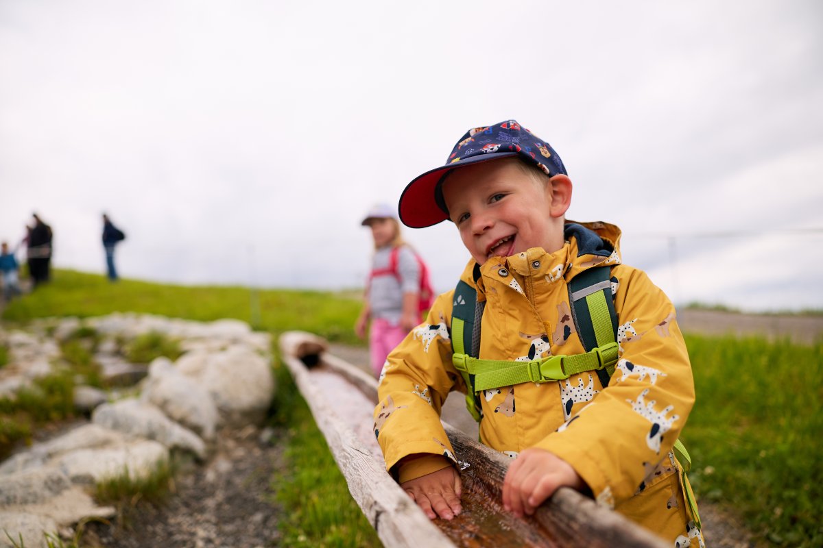
Cool water in pools and winding streams are the main attraction of this children's hike: The Burmiwasser water adventure trail starts at the Kanzelwandbahn mountain station and leads past locks, waterwheels, and babbling brooks to the Riezler Alpsee lake.
Schlappoldsee to Alpe Schlappold
Details about the hike on the Fellhorn
Walking time: approx. 30 minutes
Difficulty: easy
Families particularly enjoy hiking trail 12 on the Fellhorn, which starts at the picturesque Schlappoldsee lake. At the end of the lake, a path leads through flower meadows towards Germany's highest alpine dairy farm. Children especially love this hike, as many animals await petting at the Schlappoldalpe. Adults can enjoy a snack on the sunny terrace and purchase flavorful mountain cheese: the Schlappoldalpe also sells ham and other sausages. The well-maintained trail is also suitable for hiking with a stroller: /aktiv-sport/wandern/wandern-mit-kinderwagen/. When hiking in Oberstdorf and the Kleinwalsertal valley, our mountain lifts transport strollers to the summit free of charge.

Tip: Of course, most of the hiking trails on Kanzelwand and Fellhorn can also be started from any other point and their length can be varied. You can find more detailed information on the individual routes. And naturally, descending from the mountain station to the valley station or ascending in the opposite direction is always possible: A hike from the Kanzelwand valley station to the mountain station is always a good idea. You'll have to cover around 900 meters of elevation gain for this, and for the return trip, you can take our comfortable cable car.
Extensive and longer hikes around Fellhorn and Kanzelwand
The mountains around Oberstdorf also offer moderately challenging hikes for experienced hikers, leading along the rocky slopes of the Kanzelwand and the winding paths of the Fellhorn to beautiful viewpoints before returning to the valley. Those with good fitness and sure footing will be rewarded with expansive panoramic views of the Alps from the Fellhorn ridge, Söllerkopf, or Kanzelwandscharte.
Experience breathtaking views while hiking on Fellhorn and Kanzelwand.
Due to construction work, hiking trail 2 and the access road from the Oberen Alpe Bierenwang are closed. Please use trail 3 via the Alpe Schlappold as an alternative.
In the Allgäu region, straddling Germany and Austria, you'll cross some truly unique borders. You can forget your passport at Fellhorn and Kanzelwand, as these peaks connect the Austrian Kleinwalsertal valley and the German Allgäu without any border controls.
Hiking on Fellhorn and Kanzelwand takes you through lush meadows full of wildflowers, past babbling brooks, and offers opportunities to take a break at crystal-clear mountain lakes. In summer, the Riezler Alpsee, for example, is a particularly inviting spot. Let the Oberstdorf Kleinwalsertal cable cars take you up to the mountain stations. We've compiled the best hikes between Allgäu and Kleinwalsertal on this page.




Further hiking routes via Kanzelwand and Fellhorn
These mountain tours for experienced hikers are accessible from our stations and some lead into high alpine terrain. Please note that alpine equipment, sure-footedness, and some experience are required for these routes. Further information about these routes, their accessibility, and difficulty level can be obtained from the alpine advisory center in Oberstdorf, Tel. +49 (0)8322 / 700 2209, or the Kleinwalsertal mountain school, Tel. +43 (0)5517 / 30245.




Please note: Cycling is not permitted on the alpine path to the Schlappold alpine pasture.
Those who prefer to explore the mountains by bicycle will find beautiful alternatives in the surrounding area: The neighboring Rappenalp valley or the route towards Einödsbach offer wonderful tour opportunities with impressive natural scenery.


