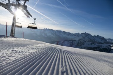
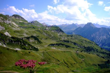
Get an overview at 2,224 m on the Nebelhorn.
Experience the border region while hiking on the Nebelhorn
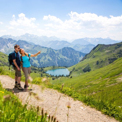
The Nebelhorn is the highest and most scenic mountain that you can reach with the Oberstdorf Kleinwalsertal Bergbahnen. From the Nebelhorn, you have a boundless view with a panoramic view of 400 peaks: far across the Allgäu Alps all the way to the Kleinwalsertal valley. The Nebelhorn mountain station is the starting point for wonderful hikes and walks with a unique Alpine panorama. In addition to steep descents, there are also easy hiking trails and barrier-free and child-friendly hikes around the 2,224-meter-high Nebelhorn summit. Enjoy wonderful hours in the summer with Hiking in the Allgäu! We have compiled the best hikes on the Nebelhorn for you.
Easy hikes in the border region at the Nebelhorn
Our selection of the most beautiful tours and hikes* on the Nebelhorn shows what awaits you when Hiking in Oberstdorf
Route 1: Panorama trail at the Höfatsblick station
Hiking details:
Walking time: approximately 30 minutes
Grade: easy
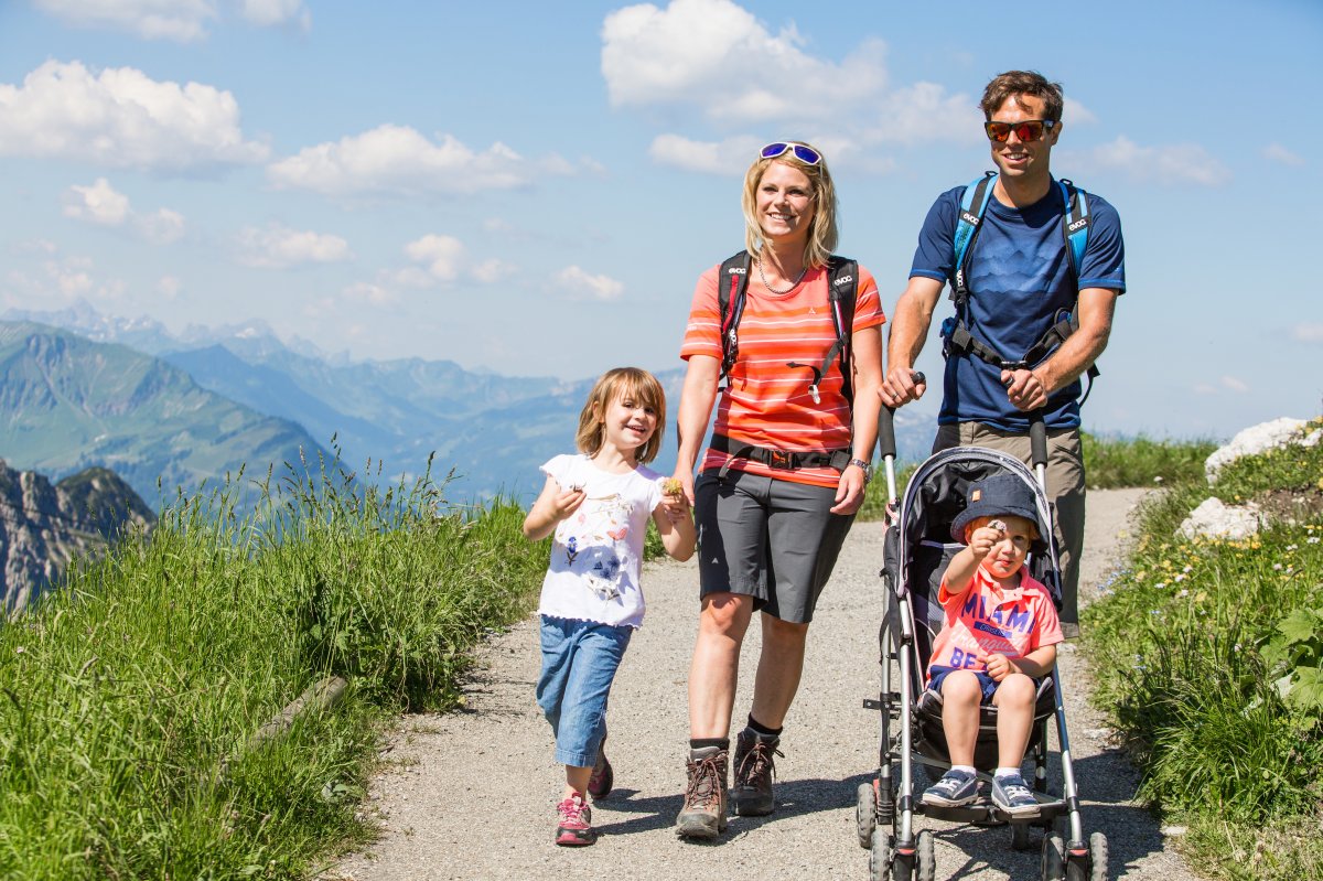
This easy hike leads from the Nebelhornbahn mountain station to the viewpoint overlooking the Faltenbachtal valley via a gentle climb. With the Höfatsblick station behind you, you'll walk on easy-to-walk gravel and asphalt, making the route easily accessible for wheelchair users or hikers with strollers. When visibility is good, the panoramic trail offers impressive views far into the Allgäu region.
Route 1a: from the summit to the mountain station
Hiking details:
Walking time: approximately 1 hour
Grade: easy
The Nebelhornbahn and Gipfelbahn gondolas take you to an altitude of 2,224 meters. From the summit, a rocky, steep hiking trail leads back down about 250 meters to the Nebelhornbahn mountain station. Before you begin your hike, walk around the summit station and take a look down the steep north face of the Nebelhorn.

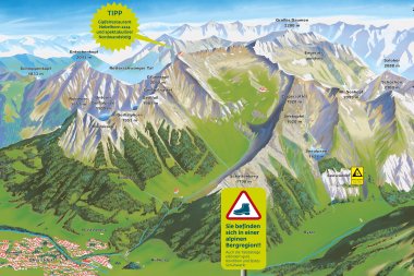
Interactive panoramic map of the Nebelhorn
Route 1c: Descent from the Seealpe via the Faltenbachtobel into the valley
Hiking details:
Walking time: approximately 1 hour
Grade: moderate
The hike starts at the Seealpe station. Descend towards Oberstdorf via the Faltenbachtobel ravine – one of the most beautiful ravine paths in the entire Allgäu region. Passing a hydroelectric power plant, which generates electricity, the trail continues to the ski jumping facility. Tip: Keep an eye out for the rare and protected animal and plant species along the way!

Route 2: Pfannenhölzle circular hike
Hiking details:
Walking time: approximately 1.5 hours
Grade: easy
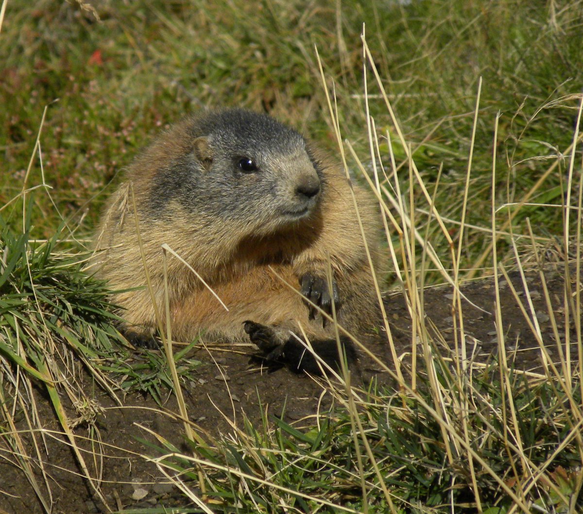
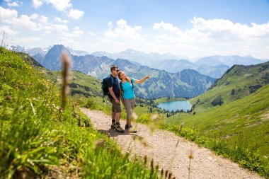
The easy hike below the Nebelhorn summit promises stunning views of the two-country region. Mountain enthusiasts start this 2-kilometer hike at the Höfatsblick mountain station towards the Koblat circular hiking trail. After the first stage, the Koblat plateau comes into view. Here, hikers can enjoy views of the Allgäu Alps and blooming alpine flora. Alpine roses, anemones, and gentians accompany us along the trail. Keep an eye out for marmots. These cute rodents like to spend time here in the summer.
Then the trail leads uphill for a short stretch before turning left into the basin. The hiking trail then descends again towards the Nebelhornbahn mountain station: /bergbahnen/nebelhornbahn/

Route 4: Höfatsweg to Zeigersattel and back
Hiking details:
Walking time: approximately 1.5 hours
Grade: easy
From the Zeigersattel, the view falls upon the mysterious Seealpsee: definitely a scenic highlight of the Allgäu region. The path to the Zeigersattel leads from the Höfatsblick mountain station along stroller-friendly dirt, gravel, and pebble paths. Rare alpine flowers line the easy trail, along which information panels reveal more about plants and other alpine inhabitants. With a little luck, hikers might spot marmots or a golden eagle.

Route 5: from the Seealpe station to the valley station via the road
Hiking details:
Walking time: approximately 1 hour
Grade: easy
From the Seealpe station, hikers begin the descent towards Oberstdorf. A gravel path leads through dense spruce forests, and an alpine road parallel to it can also be used for hiking. Whichever route you choose, you won't miss the panoramic view of the Oberstdorf mountains. After the cable car, you pass the "Audi Arena" ski jumping facility. Following the fresh, clear Faltenbach stream, you reach the Oberstdorf Ice Sports Center, from where it's not far to the cable car valley station.

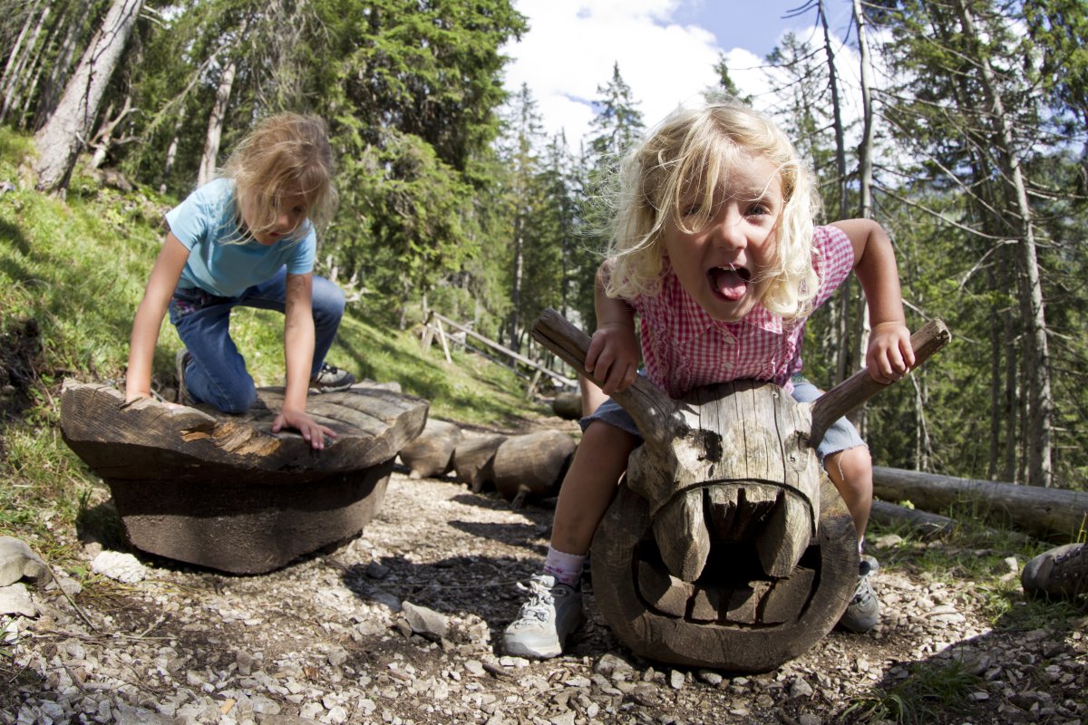
Trail 10: Nature and Adventure Trail Uff d’r Alp
Hiking details:
Walking time: approximately 1 hour
Grade: easy
The starting point for this child-friendly circular trail is the Seealpe station. Following the signs, you'll reach the alpine road after a few meters. Interactive stations tell exciting stories about life on the alpine pastures, including the animals and plants that live there. The hike leads through the Allgäu mountains to the rear Seealpe, where children encounter mysterious fairy tale and legend stations in the dark undergrowth. After crossing a high suspension bridge, the tour ends at the Seealpe station.
*Of course, most of the Nebelhorn hiking trails can also be started from any other starting point and their length can be varied. There are also a variety of other hiking options. For more detailed information, see the individual routes.
Extensive hikes on the Nebelhorn
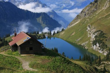
The mountains around Oberstdorf aren't just perfect for short strolls: On longer hikes, you'll immerse yourself in the tranquility and contemplation of the Allgäu Alps, listening to the gravel crunch beneath your hiking boots or the gurgling of mountain streams. These are our hiking trails for fit hikers with a walking time of up to four hours.


Further, difficult hiking tours around the Nebelhorn
These tours are accessible from our base camps and some lead into high alpine terrain. Please note that alpine equipment, surefootedness, and, in some cases, experience are required for these trails.
For further information about these trails, accessibility and difficulty levels, please contact the Alpine Advisory Center in Oberstdorf, Tel. +49 (0)8322 / 700 2209 or the Kleinwalsertal Mountain School, Tel. +43 (0)5517 / 30245


Hiking on the Nebelhorn as a varied walk
Over hill and dale, along streams: Spending time in nature isn't just something for owners; dogs also enjoy it in this two-country hiking region. For the ride in the Nebelhornbahn's large cabin, dogs must wear a muzzle. Once you reach the mountain station, however, the diverse hiking trails around the Nebelhorn summit await. Depending on your dog's fitness level and your own, choose between short panoramic trails, circular trails, and descents to the valley station. Your dog must be kept on a leash on the Nebelhorn and the other mountains of the Oberstdorf Kleinwalsertal Bergbahnen (mountain railway).


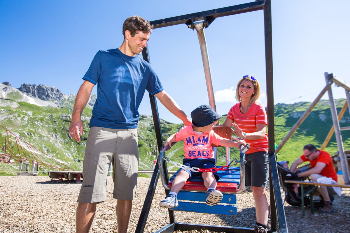
Family hike on the Nebelhorn: discover mountain animals and plants
What's that zipping through the tall grass back there? What smells so good here? Questions line the Nebelhorn hiking trails when you take your children on a family hike. Chamois, marmots, blooming mountain meadows, and gurgling springs are just a few of the attractions that await little ones in the mountains of Oberstdorf: We've equipped child-friendly hiking trails in the Allgäu and Kleinwalsertal valleys with playgrounds, ball race tracks, play stations, and much more, making hiking with children a truly special experience.