Enjoyable hiking halfway up the Heuberg – in the heart of Kleinwalsertal.
Enjoy the freedom above the mountain peaks while hiking on the Heuberg
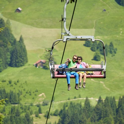
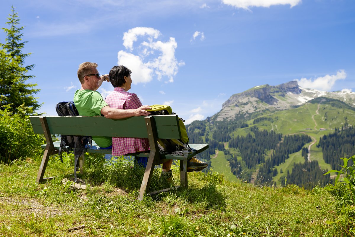
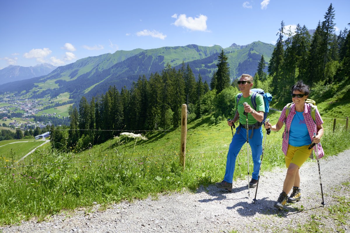
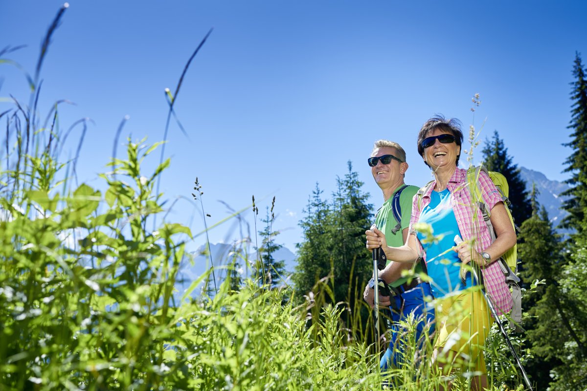
Get away from everyday life and into the Allgäu mountains: Leisure hikers appreciate the Heuberg in the middle of Kleinwalsertal for its easily accessible high-altitude trails at 1,380 meters. Between the boundless mountain panorama of the Austrian state of Vorarlberg and wonderful flower meadows, rustic mountain huts invite you to stop for a break. With the Oberstdorf Kleinwalsertal Bergbahnen you can easily master the climb to the Heuberg. Once you arrive at the Heuberg station, you can experience unforgettable moments on summer hikes. The mountain in Kleinwalsertal offers the ideal starting point for hikes and bike tours.
Easy hikes on the Heuberg in Kleinwalsertal: our tips
We have compiled a selection of the most popular short hikes* on the Heuberg for you:
Route 1: Heuberg – Bühlalpe – Baad
Hiking details:
Walking time: approximately 2.5 hours
Difficulty level: easy
The upper high-altitude trail leads through the slopes of the Heuberg. The easily accessible forest path is ideal for hiking for children and seniors. Passing dense spruce forests, magnificent flower meadows, and grazing cattle, the trail is sure to delight children. The panoramic descent begins at the Bühlalpe. The Baader high-altitude trail takes you past the Chalta spring on the Heuberg, where you can fill your water bottle with fresh mountain water. The last section follows a well-maintained hiking trail.

Route 3: Heuberg – Auenhütte
Hiking details:
Walking time: approximately 1 hour
Difficulty level: easy
The mountain station welcomes you with a view of the Gottesacker plateau and the Hochifen. The first few meters of the hike on the Heuberg lead along a paved alpine road over the Heuberg hollow, home to the orchid, a wild orchid species. The subsequent wooded path descends steeply towards the Schwarzwassertal valley. The tour can be extended at the Auenhütte or the valley station of the "Ifenbahn": /bergbahnen/ifenbahn/. The bus takes you back towards Riezlern from there.
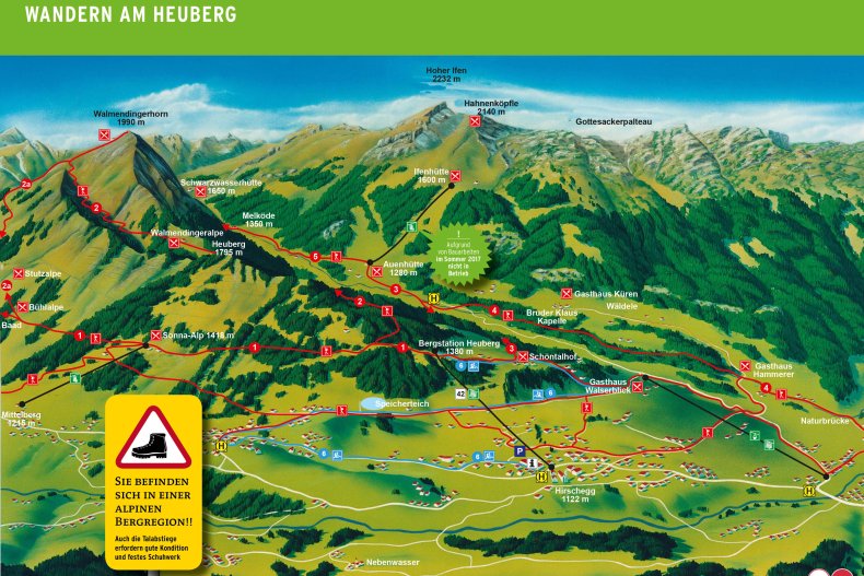
Interactive panoramic map of the Heuberg
These hiking trails on the Heuberg require a bit more fitness:
Depending on your stamina and hiking passion, the two-country hiking region also offers longer hiking routes: The challenging hikes on the Heuberg either consist of several combined trails or lead to the destination on an extended day route.
Path 2: Heuberg – Walmendingerhorn
Hiking details:
Walking time: approximately 3 hours
Difficulty level: moderate
Hike 2 on the Heuberg is a bit more challenging, so hiking boots are recommended. Hikers start from the mountain station towards Zaferna. After a sharp bend, the northern flank of the Heuberg comes into view. The wide forest path transitions into an alpine mountain trail. The multifaceted trail then leads to the pastures of the Walmendinger Alpe, idyllically situated above the Schwarzwassertal valley. After the first few meters, the climb becomes steeper, then even includes a few rocky sections. The ascent is rewarded with a view of the Trogtal valley, where gentian and alpine roses shimmer. After another rugged path, the view of the breathtaking Gottesacker and the Ifen mountain opens up. The final section leads through avalanche protection structures. The final stop is the mountain station of the “Walmendingerhornbahn”:/bergbahnen/walmendingerhornbahn/, which takes you comfortably down.
Route 2a: Heuberg - Walmendingerhorn via Bühlalpe and Stutzalpe
Hiking details:
Walking time: approximately 3 hours
Difficulty level: easy
This beautiful hiking trail winds its way from the Heuberg mountain station up to the summit of the Walmerdingerhorn, first through forest and then across meadows. The trees at the lower end of the ascent provide pleasant shade, before the forests thin out with increasing altitude. This physically demanding hike leads out onto the southern slope, which is richly covered with mountain flowers. Upon reaching the highest point of this hike, the "viewpoint mountain" rewards you with a sweeping view of the Kleinwalsertal valley.
Trail 3+4: Heuberg – Kessellöcher – Wäldele – Au – Natural Bridge – Riezlern
Hiking details:
Walking time: approximately 3 hours
Level of difficulty: moderate
You initially hike along the Schwarzwasserbach stream on the Heuberg, which then offers two options for the descent: a direct route to the Kessellöcher (Kesselloch) or a short circular route to the Auenhütte and the Ifenbahn valley station. At the Schwarzwasserbach stream, visitors gain insight into the rock layers of the Schrattenkalk (Schratten limestone). After the first few steep meters, the trail continues gently. Downstream, the trail then distances itself slightly from the Schwarzwasserbach stream and leads through flowery meadows. At the end, there's a rest area where you can cool your feet in the refreshing stream.
Trail 3+5: Heuberg - Auenhütte - Melköde – Schwarzwassertal
Hiking details:
Walking time: approximately 6 hours
Level of difficulty: moderate
If you choose this day hike, the rich nature of the Schwarzwassertal Valley will reward your efforts. From the Auenhütte, which is accessible via the easy hiking route no. 3 from Heuberg, you'll hike upstream along the Schwarzwasserbach stream and pass flower-filled alpine meadows where the cattle of the Melköde Alpine Hut graze. The hut, where mountain cheese, yogurt, and quark are made on-site, rewards the persistent hiker with a hearty snack and a beautiful view of the Schwarzwassertal Valley below the rocky Hoher Ifen.

*Of course, most of the hiking trails on the Heuberg can also be started from any other starting point and can be varied in length. You can find more detailed information on the respective routes.
General information about hiking on the Heuberg
The Heubergbahn cable car in the two-country hiking region transports guests safely, comfortably, and quickly to over 1,380 meters above sea level. A sensational view of Riezlern, Mittelberg, and Hirschegg awaits. The Heuberg offers mountain enthusiasts fantastic, varied mid-altitude trails in summer. The routes are also suitable for experienced mountain bikers, but also for leisurely hikers, families with children, or hikers with dogs. Bicycles and strollers travel free of charge on the Heubergbahn cable car. Outdoor enthusiasts can access numerous hiking trails in Kleinwalsertal from here.


